Did you know the best kayaking in Ontario includes access to over 30,000 islands in Georgian Bay alone? That’s right – Ontario’s waterways offer some of the most diverse paddling experiences in the world, whether you’re looking to explore crystal-clear waters or historic waterways.
During recent years, kayaking ontario has seen a significant surge in popularity, especially after the pandemic when many discovered the joy of local water adventures. From the historical 1000 Islands National Park with its War of 1812 battle sites to Lake Temagami with hundreds of kilometers of pristine shoreline, the best places to kayak in ontario cater to various skill levels and interests. Additionally, many of these routes – including the French River Delta with its incredible rock formations – are perfect for canoeing ontario enthusiasts as well. If you’re planning best canoe trips in ontario this summer, several of our recommended routes can accommodate both kayaks and canoes, including the scenic journey to Ragged Falls via the Oxtongue River.
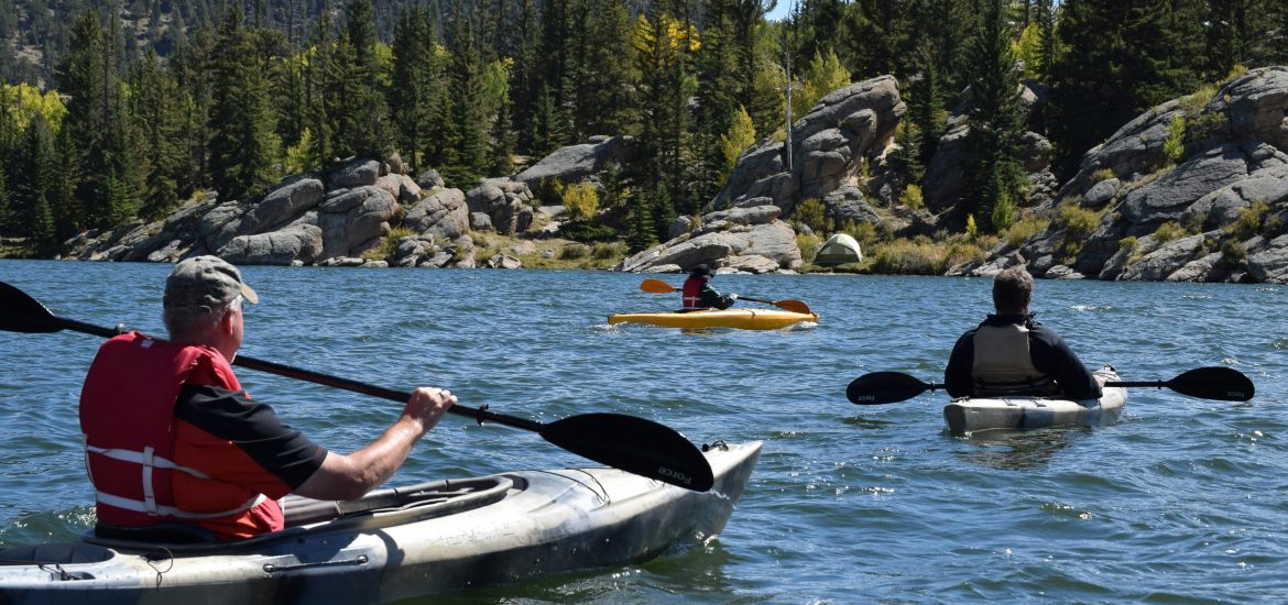
1000 Islands National Park
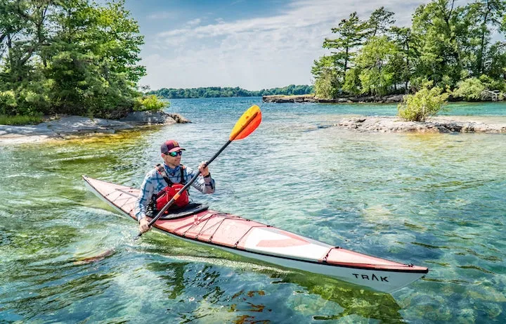
Image Source: Aqua Bound
Located where the St. Lawrence River joins the Canadian Shield with New York’s Adirondack Mountains, the 1000 Islands National Park offers paddlers a coastal wilderness experience unlike any other. Established in 1904 as St. Lawrence Islands National Park, it holds the distinction of being the first Canadian national park east of the Rocky Mountains. For kayakers seeking one of the best places to kayak in Ontario, this archipelago spanning 80 kilometers provides an ideal summer destination with its mixture of sheltered channels and open water.
1000 Islands kayaking highlights
The 1000 Islands region actually comprises 1,864 islands, with approximately 20 belonging to the national park. These granite outcrops create a paddler’s paradise where you can explore at your own pace through clear waters. Scott, owner of 1000 Islands Kayaking, aptly describes it as “accessible wilderness”.
What makes this area particularly special for kayaking Ontario enthusiasts is the diversity of experiences available. The park has organized nine distinct paddling routes for half-day and full-day trips, complete with maps identifying access points, estimated times, and points of interest. Furthermore, these routes run sequentially, allowing you to combine multiple sections for extended adventures.
Wildlife viewing opportunities abound in this UNESCO World Biosphere Reserve. Lucky paddlers might spot bald eagles soaring overhead, great blue herons stalking the shallows, or families of turtles basking on sun-warmed rocks. The geological formations and clear waters create a stunning backdrop as you paddle between islands.
History buffs will appreciate exploring the region’s rich heritage, from sunken shipwrecks to historic castles and sites steeped in First Nations history. One particularly unique spot is Half Moon Bay, a natural amphitheater where boaters have gathered since the 1800s for Sunday services during summer months.
1000 Islands skill level
Though the waters appear calm, kayaking Ontario’s 1000 Islands requires some preparation. The area is considered beginner-friendly but presents unique challenges. The park features busy boating channels with cruise ships and freighters, occasional strong currents, and weather that can change rapidly.
Most guided tours are specifically designed for beginners, with friendly certified guides providing equipment and instruction. For complete novices, half-day guided tours offer an excellent introduction to both paddling techniques and the region’s highlights.
If you’re considering a self-guided experience, some paddling experience is recommended. The 1000 Islands Kayaking company suggests having basic kayaking skills before renting equipment for independent exploration. Nevertheless, their rental process includes an orientation covering safety equipment, basic paddling strokes, and route suggestions.
For those seeking to improve their skills, certification courses are available. Level 1 Skills courses (starting at CAD 487.68 plus tax) cover boat control, rescues, and navigation fundamentals over two days. More experienced paddlers can pursue Level 2 certification (CAD 1247.06 plus tax), which focuses on advanced skills for overnight expeditions.
1000 Islands access and rentals
Access to the park islands is straightforward with several outfitters available. The 1000 Islands Kayaking Company, Misty Isles Lodge, Harmer’s Cottages, and Ahoy Rentals in Kingston all provide rental equipment and guided experiences.
Rental options typically include:
- Single kayaks (approximately CAD 34.83 for half-day, CAD 55.73 for full day)
- Tandem kayaks for sharing with a partner
- Canoes (approximately CAD 62.70 for half-day, CAD 76.63 for full day)
- Stand-up paddleboards for an alternative experience
Most rental packages come fully equipped with safety gear, detailed maps, and national park beaching permits. Consequently, you won’t need to worry about additional fees when stopping at the park islands.
For those planning overnight camping trips, outfitters can provide additional gear such as tents, camp stoves, and kitchen equipment. Alternatively, shuttle services are available to transport camping equipment to islands, allowing you to travel light in your kayak.
Remember that all vessels must have a valid mooring or beaching permit when visiting the islands. These permits must be purchased upon arrival at the island or may be included with your rental.
1000 Islands best time to go
Summer months offer the warmest conditions for paddling the 1000 Islands, with the season generally running from early May through October. The water is typically warm enough for comfortable swimming during July and August, making these months ideal for combining paddling with water play.
Nevertheless, July and August also represent the busiest periods at the park. For a more tranquil experience with less boat traffic, consider visiting during June or September. The shoulder seasons offer similar paddling conditions with fewer crowds, therefore providing a more peaceful wilderness experience.
Weather conditions can vary throughout the paddling season. Morning outings generally offer calmer waters, while afternoon winds can create more challenging conditions. Above all, checking weather forecasts before setting out is essential, as storms can develop quickly on the St. Lawrence River.
Given the region’s popularity among the best canoe trips in Ontario enthusiasts, booking rentals and guided tours 48 hours in advance is recommended, particularly for weekends and holidays. Similarly, while many campsites are first-come, first-served, reservations are available for certain islands (Beau Rivage, Mulcaster, and Camelot) beginning in April.
The 1000 Islands region stands as one of the truly accessible wilderness paddling destinations in Ontario, suitable for various watercraft including both kayaks and canoes. With its combination of sheltered channels, fascinating history, and stunning natural beauty, it deserves its reputation as among the best kayaking in Ontario.
French River Delta
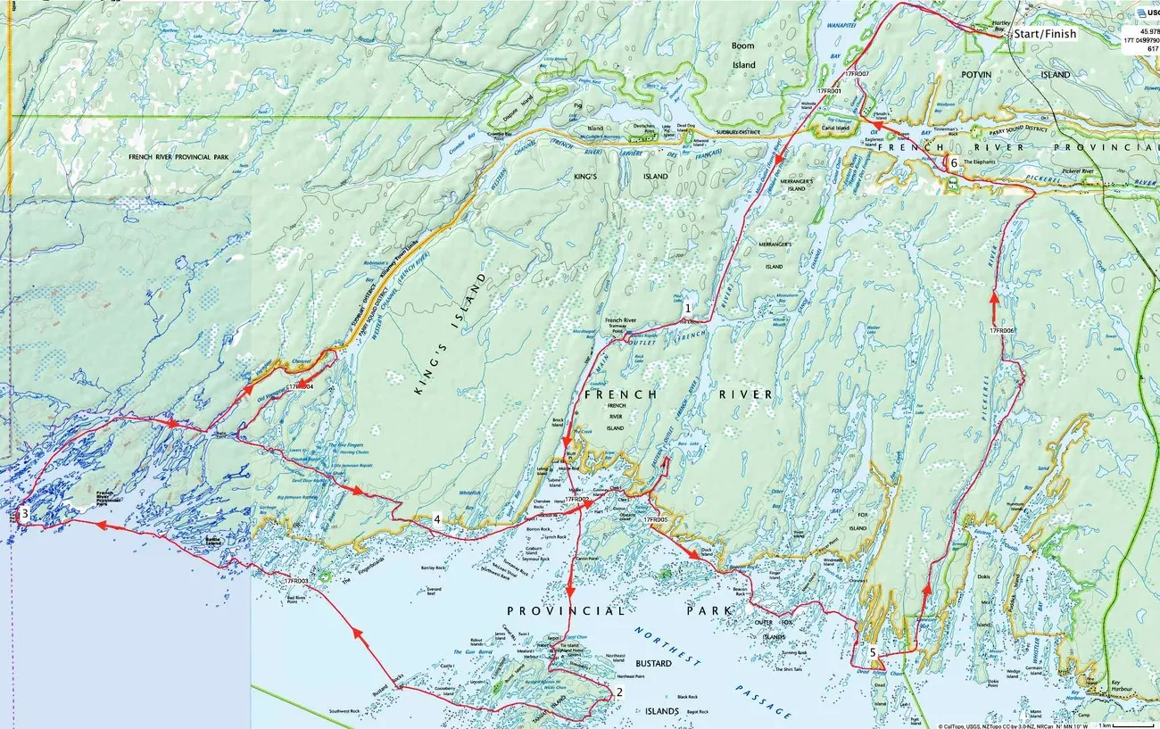
Image Source: Ramblin’ Boy
Flowing 105 kilometers from Lake Nipissing to Georgian Bay, the French River offers kayakers a historic paddling experience through one of Ontario’s most beloved waterways. As Canada’s first designated Canadian Heritage River, this historic route once served Indigenous peoples, French explorers, fur traders, and voyageurs. The French River Delta—where the river meets Georgian Bay—creates a paddler’s paradise with countless islands and hidden channels that barely fit a kayak.
French River Delta route highlights
The delta region presents a mesmerizing interface where open water meets ancient rock, capturing the essence of paddling on what some call the “Sixth Great Lake”. What makes this area truly special for best kayaking in Ontario enthusiasts is its largely undeveloped character and the myriad of waterways to explore.
Several distinct routes cater to different preferences:
The Old Voyageur Channel: A historic 3.2-kilometer route with only one portage, said to be one of the main passages used by voyageurs. This channel offers spectacular scenery with narrow passages and smooth, large boulders dotting the water.
The Cross-Channel System: Comprising the 4.4 km East Cross-Channel (from Whitefish Bay to Devil’s Door) and the 3.2 km West Cross-Channel (from Devil’s Door Rapids to Black Bay). These interior passages allow progress even when strong winds hammer the coast.
Main Outlet: Along with the Old Voyageur Channel, this was historically used by fur traders and offers a direct route with one short portage around Dalles Rapids.
Many paddlers choose the figure-8 route: paddling down the French River to Georgian Bay and back up using different channels. This approach means “you barely covered the same water twice”, maximizing scenic variety between river passages and open bay waters.
For those seeking wilderness immersion, the delta contains hundreds of small islands and shoals perfect for exploration. The crystalline waters, polished granite shorelines, and countless secret channels between islands create opportunities to spot wildlife like black bears, white-tailed deer, and shorebirds.
French River Delta skill level
The French River Delta is considered suitable for novice to intermediate paddlers, primarily because there is minimal portaging required. Most rapids can be bypassed, and many can be run depending on water levels and your comfort with whitewater.
First-time visitors should note:
- The French River has few portages compared to other canoeing Ontario routes, making it one of the easiest wilderness trips in the province
- Wind conditions can significantly affect paddling difficulty, especially in Georgian Bay’s more exposed areas
- Navigation can be challenging—the hundreds of look-alike islands can confuse even experienced navigators
For kayaking Ontario’s French River Delta safely, bring detailed maps, brush up on map and compass skills, and carry a GPS to confirm your location, as cell phone signals are unreliable in these remote waters. Additionally, the area is home to Massassauga rattlesnakes and poison ivy, so appropriate caution is advised.
French River Delta access and outfitters
Several excellent access points and outfitters serve the French River area:
Hartley Bay Marina (2870 Hartley Bay Road) stands as a popular launching point for delta explorations, offering canoe rentals, fishing guides, parking facilities, and route guidance. From here, the figure-8 route covers approximately 40 km with one portage and a tramway to pull your vessel through.
Other notable access options include:
- French River Supply Post and Marina (193 French River Supply Post Road), providing rentals, parking, and local expertise
- Lodge at Pine Cove (1013 Hwy 528A), offering guided trips and beautiful cabin accommodations
- French River Adventures in Noelville, featuring rentals and water taxi services
For guided experiences, outfitters like Black Feather Wilderness Adventures offer all-inclusive guided sea kayak tours that showcase the French River’s highlights. For self-guided trips, most rental businesses provide essential orientation covering safety equipment, basic strokes, and route recommendations.
French River Delta best time to go
The paddling season on the French River generally runs from late spring through early fall. However, certain considerations can enhance your experience:
Early May and late September offer exceptional solitude, as you’ll likely encounter few other paddlers beyond cottage areas. As a matter of fact, after Labor Day weekend (first weekend in September), traffic drops by 80-95%.
Summer months (July-August) provide warmer water for swimming but can be busier. Regardless of timing, the Delta area beyond the cottages—particularly in the Old Voyageur Channel, Cross Channel, and Georgian Bay islands—offers the most tranquil experiences.
Weather varies throughout the season, with water levels controlled by a dam at Lake Nipissing. Higher spring water levels can create occasional rapids not present later in the season. Furthermore, winds can pick up in August, making Georgian Bay paddling more challenging.
For those planning a French River expedition, a 3-5 day trip is ideal for exploring the Delta region, allowing time to navigate the channels, find perfect campsites, and truly appreciate why this historic waterway ranks among the best places to kayak in Ontario.
Lake Temagami
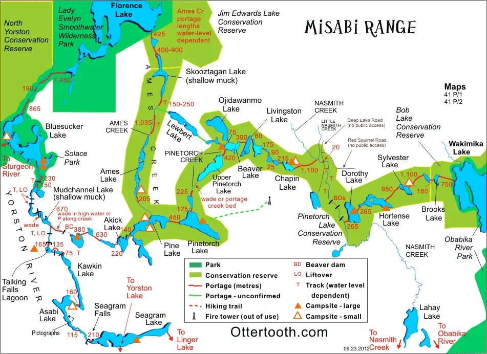
Image Source: Ottertooth.com
With hundreds of kilometers of undeveloped shoreline and over 1,200 islands dotting its surface, Lake Temagami stands as one of Ontario’s most intriguing bodies of water for paddling adventures. The name “Te-mee-ay-gaming” translates to “deep water by the shore” in Ojibwe, accurately describing this sprawling lake that stretches 45 kilometers north to south and 35 kilometers east to west. For kayakers seeking pristine wilderness without lengthy portages, Lake Temagami offers an exceptional destination that rivals Great Lakes paddling experiences.
Lake Temagami kayaking features
What makes Lake Temagami truly special among the best places to kayak in Ontario is its remarkable blend of accessibility and wilderness. The lake features nearly 5,000 kilometers of shoreline, creating countless routes for multi-day adventures. Unlike many inland lakes, Temagami’s vast expanse and deep bays make it ideal for sea kayak touring without the need for frequent portaging.
The landscape surrounding Lake Temagami adds to its appeal. Towering old-growth pine forests—some of the largest remaining ancient red pine stands in the world—create a stunning backdrop as you paddle along rocky shorelines. Bear Island, located at the lake’s center, serves as home to the Temagami First Nation whose ancestors have navigated these waters for millennia.
Notably, the lake’s numerous islands provide excellent camping opportunities and sheltered passages, allowing you to design routes based on your preferences and weather conditions. From Temagami Island with its 300-year-old pines to various lookout points offering panoramic views, each day brings new discoveries as you explore this paddler’s paradise.
Lake Temagami skill level
Primarily suited for beginner to intermediate paddlers, Lake Temagami offers relatively protected waters compared to Great Lakes paddling. Nonetheless, the lake’s size means weather conditions can change rapidly, requiring basic navigation skills and weather awareness.
For those new to kayaking Ontario waters, starting with day trips from access points before attempting overnight expeditions is advisable. The Central Lake Temagami Access Road provides a convenient starting point, allowing you to gradually build confidence exploring the lake’s arms and bays.
More experienced paddlers might consider combining Lake Temagami with adjacent waterways like the challenging Temagami River, which offers some of Ontario’s best whitewater for intermediate to advanced paddlers. Alternatively, connecting to smaller, more intimate routes like the Obabika River provides different paddling experiences within the region.
Lake Temagami access and rentals
Several outfitters serve the Temagami region, making access straightforward:
- Temagami Outfitting Company provides sea kayak rentals, guided and self-guided trip packages, and shuttle services from their waterfront base in Temagami village
- Smoothwater offers various canoe rentals including ultralight models weighing 45 lbs or less
- The Lodge at Pine Cove combines comfortable accommodations with paddling access
Rental prices vary by outfitter, yet typically include essential safety equipment. At Smoothwater, expect to pay approximately $50 per day for ultralight 16′ kevlar canoes or $37 daily for standard models. Most outfitters require a 50% deposit when booking, with cancelation policies varying based on timing.
Access points include the Central Lake Temagami Access Road—a gravel road 18 km from Route 11—along with several other launch sites around the lake’s perimeter.
Lake Temagami best time to go
The paddling season in Temagami typically runs from late spring through early fall. Summer months (July-August) offer the warmest conditions for swimming and camping, yet correspondingly attract more visitors.
Essential to note, the Temagami Cluster of Parks implemented a new reservation system for backcountry camping. Rather than general registration, you now reserve specific “lake(s) zones” for each night of your trip. Reservations open five months in advance, allowing you to secure your preferred zones well ahead of time.
This system provides several advantages:
- Guaranteed camping availability within your reserved zone
- Flexibility to choose specific sites on a first-come basis
- More even distribution of visitors throughout the park
For the most serene experience among the best kayaking in Ontario destinations, consider visiting in June or September when fewer paddlers explore the lake but conditions remain favorable for multi-day adventures.
Rossport Islands (Lake Superior NMCA)
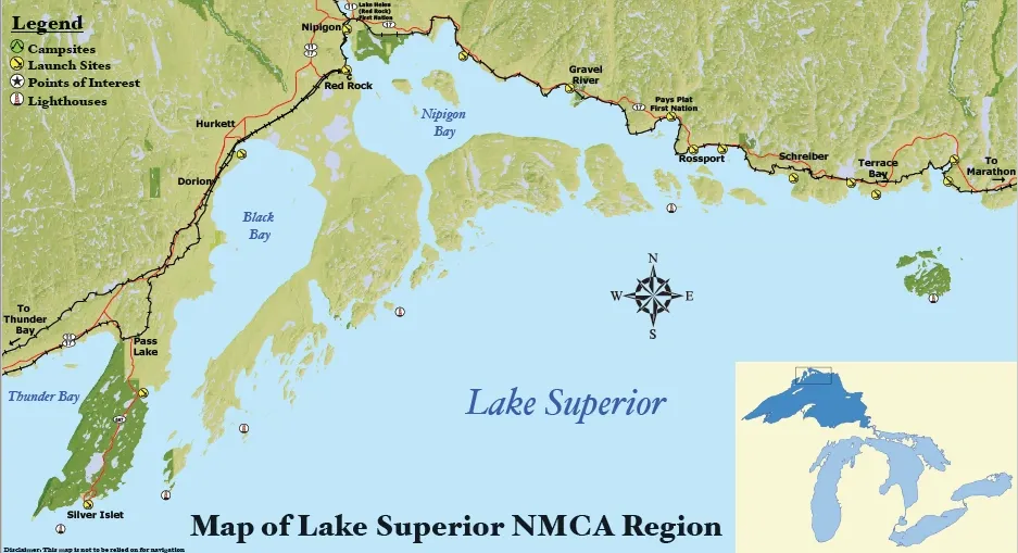
Image Source: Such A Nice Day Adventures
Among Lake Superior’s countless treasures, the Rossport Islands archipelago stands out as a premier destination for kayakers seeking protected waters within a wilderness setting. Located in the Lake Superior National Marine Conservation Area, this collection of islands forms the largest archipelago on the lake, offering endless exploration opportunities through pristine waters and sheltered channels.
Rossport Islands kayaking highlights
The Rossport Archipelago provides a safe haven for paddlers within the vastness of Lake Superior. What makes this area truly exceptional for best kayaking in Ontario enthusiasts is the protective shield created by several tiers of islands. The inner harbor around Rossport village offers calm waters ideal for beginners, while more adventurous routes extend to outer islands.
Key paddling routes include:
- Quarry Island Circuit: A popular day trip featuring crystal-clear waters, sandstone cliffs covered in orange lichen, and a wilderness hiking trail leading to the Rossport Lookout with panoramic views of the village and surrounding islands.
- Channel Island Exploration: Navigate through stunning Steamboat Channel where beautiful clear green water meets low cliffs of brick red, pink, gray and black Jacobsville sandstone – billion-year-old banded rock formations.
- Battle Island Lighthouse: For multi-day adventures, this island features a working lighthouse and basic amenities including outhouses, a firepit, and tenting sites. The lighthouse has witnessed some of Lake Superior’s greatest storms throughout its 140-year history.
Wildlife viewing adds to the experience—paddlers might spot peregrine falcons nesting in the cliff faces or discover natural treasures like agate beaches along shorelines.
Rossport Islands skill level
Although the archipelago offers sheltered paddling opportunities, Lake Superior demands respect from all visitors. Even experienced paddlers should seek guidance from local outfitters before embarking on independent trips.
For beginners, the harbor around Rossport provides one of the most protected paddling environments on Lake Superior. First-time paddlers can safely explore the inner islands around Rossport’s harbor under the guidance of experienced instructors.
Intermediate paddlers can venture further to explore the outer island chains, yet must remain vigilant as conditions can change rapidly. The channels between islands may seem placid, yet can develop “confused seas” when winds approach from multiple directions.
Cold water temperatures persist throughout summer, necessitating appropriate safety gear including wetsuits or drysuits for longer excursions. Furthermore, even on calm days, submerged rock shoals present hazards to navigation.
Rossport Islands access and outfitters
The village of Rossport serves as the primary gateway to this paddling paradise. Its public boat launch provides direct access to the archipelago, making it an ideal starting point for day trips or extended explorations.
Several outfitters service the area:
- SAND Adventure Expeditions offers guided day tours, multi-day expeditions, kayak rentals, and instructional programs.
- Naturally Superior Adventures provides guided trips ranging from half-day tours to multi-day expeditions along the coast.
For independent paddlers with appropriate skills and safety knowledge, equipment rentals typically include all necessary safety gear and local guidance on current conditions and route selection.
Accommodations in Rossport include the Willows Inn B&B with harbor views, Serendipity Gardens Guest House, plus camping options at nearby Rainbow Falls Provincial Park.
Rossport Islands best time to go
The paddling season runs from May through September, with July and August offering the warmest conditions. Summer months provide the best overall experience for most paddlers, although the water remains cold throughout the season.
In light of Lake Superior’s unpredictable nature, checking weather forecasts before heading out is essential. Even during summer, conditions can change rapidly. The lake’s vastness—with 250 miles of fetch between Rossport and Duluth—can generate massive waves during storms.
Early season (May-June) and late season (September) provide greater solitude, whereas the main summer months see more paddling traffic. Whenever you choose to visit, Rossport’s sheltered archipelago offers one of the most accessible wilderness paddling experiences on the entire Great Lake, earning its reputation among the best places to kayak in Ontario.
Unlike some other destinations that work well for both canoeing Ontario and kayaking, the Rossport Archipelago is primarily suited for sea kayaks due to Lake Superior’s conditions. The vessels’ enclosed design provides greater safety in this vast, cold-water environment.
Thunder Bay & Little Pigeon Bay
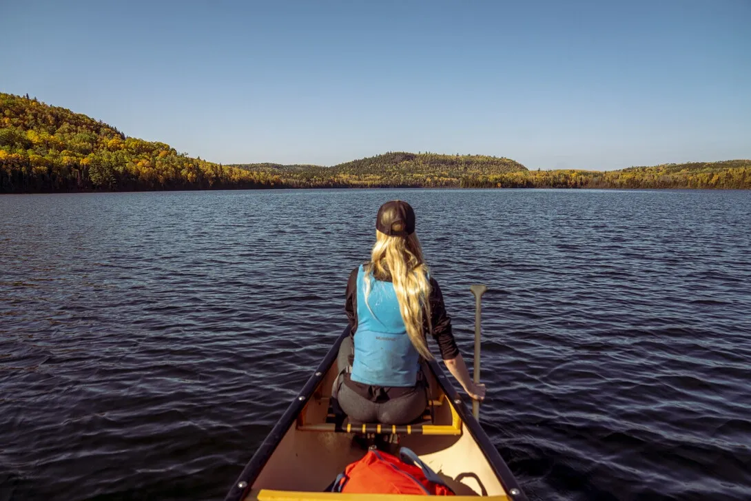
Image Source: Northern Ontario Travel
Highway 61 south of Thunder Bay—known as the Blues Highway—offers kayakers stunning access to Lake Superior’s magnificent blue waters. This stretch of shoreline serves as an excellent basecamp for day trips to various launch sites, making it one of the best places to kayak in Ontario for both beginners and experienced paddlers.
Thunder Bay kayaking features
Thunder Bay’s paddling scene combines urban exploration with wilderness adventure. The area boasts undeveloped shorelines, alluring islands, skyscraping cliffs, and coastal wetlands teeming with waterfowl. For a fascinating day trip, launch from Little Pigeon Bay near the Minnesota border to access the aptly named Boxcar Islands.
Urban enthusiasts might appreciate Thunder Bay Harbor—once the largest grain port in the world—where abandoned ore docks and towering grain elevators create a unique paddling backdrop. As you glide through these waters, you’ll enjoy unobstructed views of the legendary Sleeping Giant formation rising 1,000 feet above the water.
Thunder Bay skill level
This region accommodates paddlers of all abilities. The harbor around Thunder Bay offers calmer waters suitable for novices, yet the open lake presents challenges even for seasoned kayakers. Several areas near the city provide beginner-friendly paddling opportunities, including Boulevard Lake where kayaks and stand-up paddleboards are common sights during summer months.
Experienced kayakers can venture to Thunder Cape or explore the Welcome Islands cluster located 10 km offshore. These adventures require proper skills and weather awareness, as Lake Superior conditions can change rapidly.
Thunder Bay access and rentals
Multiple outfitters serve the Thunder Bay area:
- Wilderness Supply Company offers solo kayaks from CAD 62.70 per day (standard) or CAD 104.50 (premium)
- Chaltrek provides equipment and local information
- Such a Nice Day Adventures offers guided experiences
Rental packages typically include PFDs, paddles, plus foam and straps for vehicle transport. Many outfitters offer multi-day discounts, moreover, pickup after 2:00 pm and return before noon on adjacent days incurs no additional charges.
Thunder Bay best time to go
Summer months provide ideal paddling conditions in this northern region. Throughout this period, urban waterways like the McIntyre and Kaministiquia Rivers attract local paddlers.
For those seeking historical context alongside your paddling adventure, visit Fort William Historical Park afterward to learn about the area’s significance in the Canadian fur trade. This region truly exemplifies why kayaking Ontario continues to grow in popularity among outdoor enthusiasts.
Ragged Falls via Oxtongue River
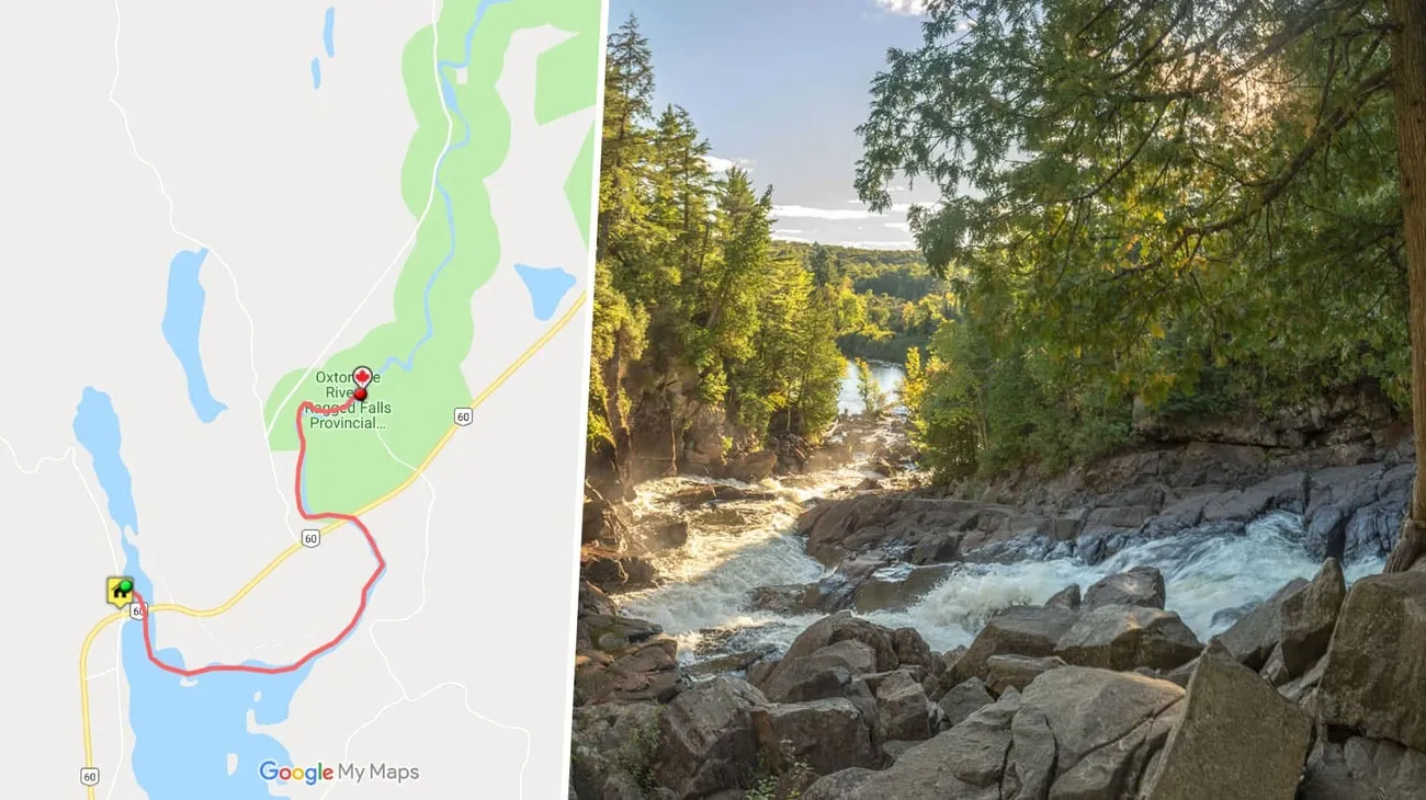
Image Source: Discover Muskoka
Ragged Falls, the first major waterfall in the Muskoka watershed, awaits paddlers just minutes from Algonquin Park’s West Gate. This picturesque destination offers one of the most accessible paddling adventures among the best kayaking in Ontario options, ideal for those seeking a memorable day trip without committing to overnight camping.
Oxtongue River route overview
The journey to Ragged Falls begins at Algonquin Outfitters’ Oxtongue Lake store dock. This scenic paddle takes you through calm lake waters before entering the Oxtongue River, ultimately leading to the base of the impressive falls. The round trip typically requires 3-4 hours, making it perfect for a half-day adventure with time to explore. Indeed, upon reaching the falls, many paddlers disembark to hike to the top for breathtaking panoramic views and perhaps enjoy a picnic lunch amid the natural surroundings.
Oxtongue River skill level
This paddling adventure is deliberately designed for beginners, ranking among the most accessible kayaking Ontario experiences. The route follows relatively calm waters suitable for novice and intermediate paddlers. Unlike other sections of the Oxtongue River that feature rapids requiring portaging, this particular stretch presents minimal challenges, hence making it an excellent introduction to river paddling for newcomers.
Oxtongue River access and rentals
Algonquin Outfitters at Oxtongue Lake serves as the primary outfitter, offering various rental options:
- One-person kayaks (CAD 55.71)
- Two-person kayaks (CAD 69.64)
- Two-person canoes (CAD 55.71)
- Three-person canoes (CAD 69.64)
All rentals include essential safety equipment, paddles, PFDs, and a route map. For larger groups, they even offer a 10-passenger North Canoe—a replica of vessels used by voyageurs—available with advance reservation.
Oxtongue River best time to go
The Ragged Falls paddle trip operates from May through early October, weather and water conditions permitting. Meanwhile, summer months provide the warmest paddling conditions. Initially, spring offers higher water levels, subsequently creating more dramatic falls, whereas late summer brings more moderate flow. This route undoubtedly belongs among the best places to kayak in Ontario for both kayakers and canoeists seeking a satisfying day adventure.
Killarney & Philip Edward Island
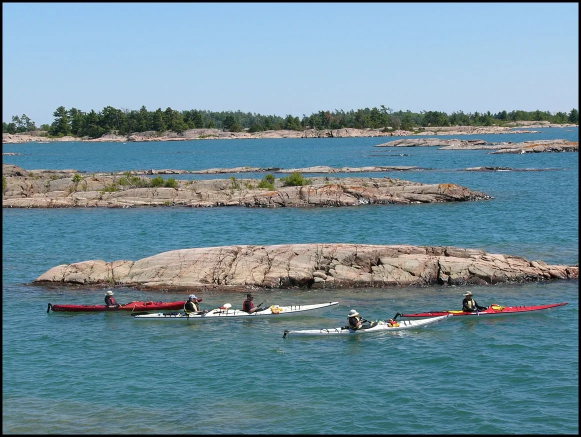
Image Source: Killarney Outfitters
Renowned for its gleaming white quartzite mountains and crystal-clear topaz lakes, Killarney Provincial Park alongside Philip Edward Island offers what many enthusiasts consider the crown jewel experience of best kayaking in Ontario. This coastal expedition brings you face-to-face with breathtaking Georgian Bay vistas, creating a perfect blend of sheltered passages and open water adventure.
Killarney kayaking highlights
Philip Edward Island presents a challenging yet accessible 50-kilometer circumnavigation route through the UNESCO Georgian Bay Biosphere Reserve. Most paddlers tackle this journey counterclockwise to minimize exposure to prevailing westerly winds. At times, you’ll navigate through Collins Inlet—a protected channel along the north shore where Canadian historical figures once traveled. Alternatively, exploring the Fox Islands just south of Killarney Provincial Park rewards you with remote backcountry islands and some of Ontario’s clearest stargazing skies.
Killarney skill level
The Philip Edward Island route suits novice to intermediate paddlers. The north and east sides remain quite sheltered, yet the south side lies exposed to Georgian Bay’s sometimes challenging conditions. According to Killarney Outfitters, this coastal expedition allows you to gain valuable expeditionary skills in a controlled environment. First-time visitors should note that Collins Inlet can get busy with pleasure boat traffic—stay close to shore for safety.
Killarney access and outfitters
Two primary launch points serve this area:
- Chikanishing Creek access within Killarney Provincial Park (includes parking fees of CAD 20.20/day)
- Town docks in Killarney
Killarney Outfitters provides comprehensive services including sea kayak rentals, trip planning assistance, plus water taxi shuttles. Their rental fleet features 17′ expedition sea kayaks from brands like Current Design, Seaward, and Boreal Design. Plus, they offer all-inclusive outfitting packages with high-quality gear and well-balanced wilderness menus—crucial as paddlers typically need 2000-3000 calories daily.
Killarney best time to go
For optimal experiences, plan your expedition between late spring through early fall. Certainly, wind conditions largely dictate your route and direction—get a long-range marine forecast beforehand or bring a radio to check weather channel 88.9 FM during your trip. For weather emergencies on Georgian Bay, marine radio channel 16 works for emergencies. As a precaution, carry extra rations, proper safety gear, and always inform someone of your trip itinerary.
Conclusion
Ontario truly stands as a paddler’s paradise with its diverse waterways catering to all skill levels and preferences. Throughout these seven routes, you’ll discover everything from the historically rich 1000 Islands National Park to the wilderness expanse of Lake Temagami. Undoubtedly, each destination offers its own unique charm – whether you seek the sheltered archipelagos of Rossport Islands or the dramatic landscapes surrounding Killarney.
For those new to paddling, routes like Ragged Falls via the Oxtongue River provide perfect starting points with minimal challenges and rental equipment readily available. Additionally, many routes including the 1000 Islands, French River Delta, and Lake Temagami accommodate both kayaks and canoes, making them ideal for group trips with mixed watercraft preferences. Nevertheless, some destinations such as the Rossport Islands on Lake Superior are primarily suited for sea kayaks due to the large, cold-water environment.
Weather conditions significantly impact your paddling experience regardless of location. Therefore, checking forecasts before setting out remains essential, particularly when exploring larger bodies of water like Georgian Bay or Lake Superior. Likewise, planning your visit during shoulder seasons (June or September) often rewards you with similar paddling conditions but fewer crowds than peak summer months.
Each of these seven routes showcases why Ontario ranks among North America’s premier paddling destinations. The province’s waterways offer breathtaking scenery, wildlife viewing opportunities, and historical connections that create meaningful adventures for paddlers of all experience levels. Although these routes represent just a small sample of Ontario’s paddling possibilities, they provide perfect starting points for your exploration of the province’s remarkable water trail network.
The time has come to grab your paddle, select your route, and experience firsthand why Ontario’s waterways continue to captivate paddlers season after season. Before long, you might find yourself planning return trips to explore even more of the province’s 30,000+ islands and countless kilometers of pristine shoreline.