

Lost on a trail with no cell service? Unfortunately, this nightmare scenario happens to hikers more often than you’d think.
The best hiking apps now offer robust offline capabilities, essentially turning your smartphone into a reliable navigation device even when you’re miles from the nearest signal. Whether you’re trekking through remote mountains or exploring dense forests, these apps store detailed maps directly on your device. Fortunately, you no longer need to choose between modern navigation tools and venturing into areas without coverage.
From comprehensive trail databases to life-saving safety features, we’ve tested and compiled the 15 best hiking apps that truly work without cell service. Each app on our list offers unique benefits for different types of hikers, specifically tailored to various terrains and experience levels. Let’s explore these reliable companions for your next adventure.
Gaia GPS
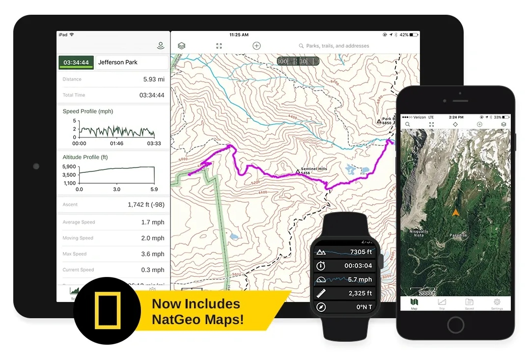
Gaia GPS stands as one of the most comprehensive mapping applications for adventurous hikers who venture beyond marked trails. This powerful tool transforms your smartphone into a reliable navigation device that functions perfectly without cellular connectivity.
Gaia GPS key features
Gaia GPS offers an extensive catalog of over 250 maps, including USGS Topo, Satellite imagery, and specialized overlays like Slope Angle and Public Land boundaries. The app enables users to record tracks, plan routes, and drop waypoints for navigation. Furthermore, you can layer multiple maps simultaneously, adjusting their opacity to create custom views for different terrains and purposes.
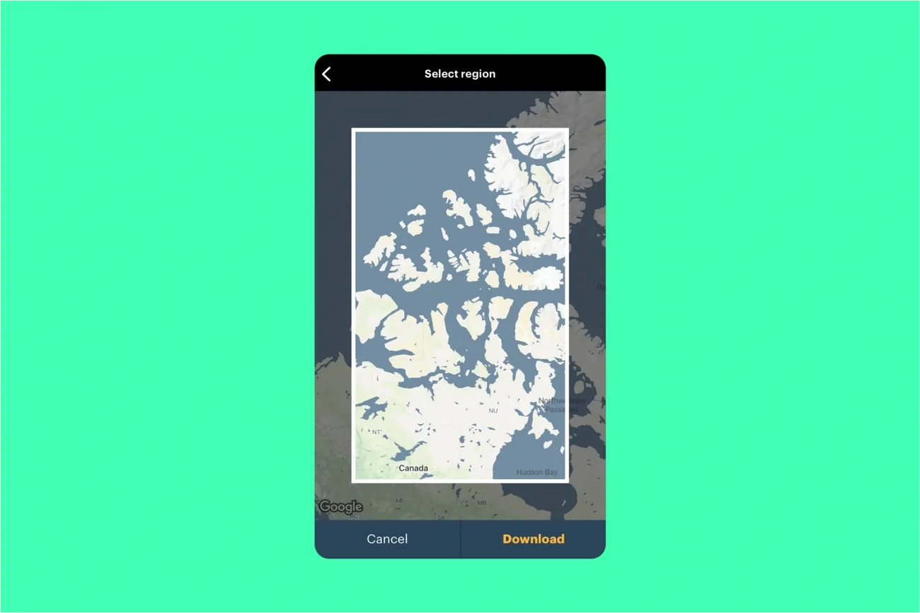
Gaia GPS offline capabilities
The app truly shines with its offline functionality. Users can download maps directly to their devices in varying resolutions (low, medium, or high). Once downloaded, the built-in GPS chip in your smartphone continues working without cell service—even in airplane mode. Additionally, Gaia optimizes their proprietary topo maps for “quick and tiny downloads” while maintaining essential details.
Gaia GPS pricing
Gaia offers a free version with basic functionality but requires a Premium Membership (CAD 55.72/year) for offline capabilities. The Premium tier unlocks the full map catalog plus downloadable maps. Moreover, a Premium with Outside+ membership includes additional benefits beyond mapping.
Gaia GPS best use case
Gaia excels for thru-hikers, backcountry explorers, and those who frequently venture off established trails. The app particularly benefits hikers who need detailed topographic information or want to explore areas with limited trail marking.
AllTrails

With over 450,000 curated trails and 80 million users worldwide, AllTrails has established itself as one of the most popular hiking apps globally. This user-friendly platform offers comprehensive navigation tools for outdoor enthusiasts at various experience levels.
AllTrails key features
AllTrails provides an extensive database of trails verified by experts and reviewed by community members. Users can apply detailed filters to find trails based on specific criteria such as distance, elevation gain, and accessibility requirements. The app allows hikers to track their activities, save favorite routes to customisable lists, and access community-generated photos and reviews. Even the free version enables users to navigate trails with cell service, share experiences, and contribute to the hiking community.
AllTrails offline capabilities
The standout feature for Plus and Peak subscribers is the ability to download interactive maps for offline use. This crucial capability ensures navigation remains possible even in remote areas without cell service. Beyond individual trail downloads, Plus members can download entire parks or custom geographic areas containing up to 500 trails. Offline maps store essential information including trail details, elevation data, and recent community reviews.
AllTrails pricing
AllTrails offers three subscription options:
Base (Free): Includes basic search, filters, and navigation with cell service
Plus (CAD 50.15/year): Adds offline maps, wrong turn alerts, 3D map previews, and real-time sharing
Peak (CAD 111.47/year): Incorporates all Plus features along with AI-powered tools like Community Heatmaps and Trail Conditions
AllTrails best use case
AllTrails excels for day hikers exploring marked trails, especially those who frequently venture into areas with limited or no cell coverage. The app is ideal for hikers who value community insights and wish to discover new trails based on user reviews and ratings. Plus and Peak subscriptions are particularly valuable for regular hikers seeking reliable navigation tools and enhanced safety features in remote locations.
OS Maps
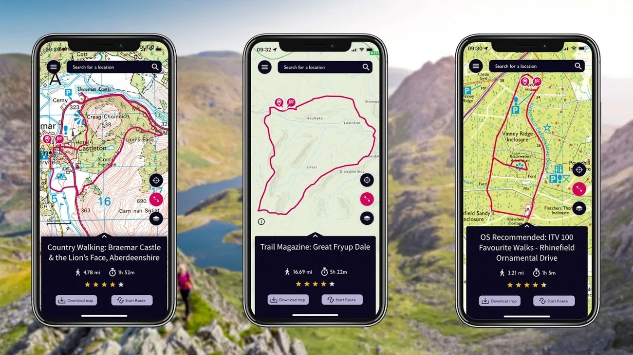
Developed by Britain’s national mapping service, OS Maps offers hikers unrivaled detailed topographic mapping, particularly for exploring the United Kingdom. This trusted navigation tool combines expert cartography with modern functionality for outdoor enthusiasts.
OS Maps key features
OS Maps provides access to all 607 OS Leisure maps across Great Britain with a premium subscription. The app enables quick and easy route plotting with a snap-to-path feature that streamlines planning. Beyond basic mapping, users can access 3D visualisations to preview terrain before heading out. The platform also includes thousands of pre-made routes from outdoor organisations and publications.
OS Maps offline capabilities
For areas with poor reception, OS Maps allows premium users to download custom map areas and routes directly to their devices. Once downloaded, the maps remain accessible without phone signal, using your device’s GPS to track location even in flight mode. This offline functionality works without consuming mobile data, helping preserve battery life during extended hikes.
OS Maps pricing
OS Maps offers two subscription tiers:
Free: Basic worldwide OS Standard mapping and route planning
Premium: £34.99/year or £6.99/month, includes offline maps, all 607 OS Leisure maps, printing capability, and international topographic maps
OS Maps best use case
OS Maps excels for hikers exploring the British countryside, given its origins as the UK’s official mapping service. Additionally, the app proves valuable for those who appreciate traditional, detailed topographic maps translated into digital format. First-time navigators benefit from its user-friendly interface that makes complex navigation more accessible.
Komoot
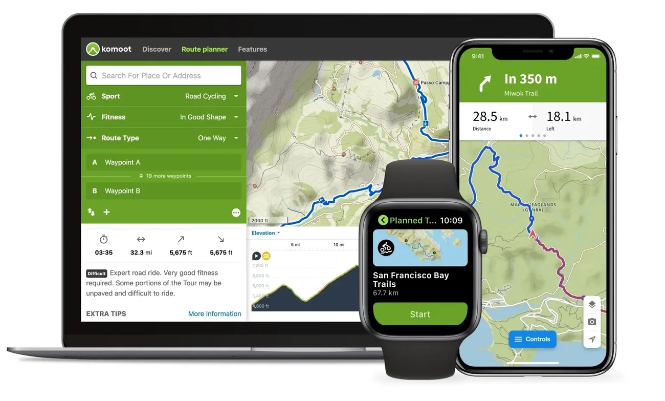
Designed for outdoor enthusiasts, Komoot combines powerful route planning with a vibrant community platform to create a uniquely social navigation experience for hikers and other adventurers.
Komoot key features
Komoot excels with its intelligent route planning that adapts to different activities like hiking, cycling, and mountain biking. The app’s standout features include Trail View (photo snapshots of paths), community Highlights (recommended spots), and detailed terrain analysis. Notably, Komoot uses the Swiss Alpine Club trail grading system (T1-T6) to indicate technical difficulty, helping hikers assess trails suitable for their abilities. Users can also view comprehensive elevation profiles for every route.
Komoot offline capabilities
After unlocking a region, users can download both planned routes and entire map areas for offline navigation. Once stored, Komoot provides full voice navigation and map functionality without internet connection. However, unlike some competitors, route planning requires internet access even in offline mode.
Komoot pricing
Komoot offers flexible pricing options:
Single Region: CAD 5.56 (one-time purchase)
Region Bundle: CAD 12.53 (one-time purchase)
World Pack: CAD 41.79 (one-time purchase, all regions)
Premium: CAD 82.21/year (includes additional features beyond maps)
Komoot best use case
Komoot particularly serves hikers who value community insights and detailed route planning. The app excels for adventures in Europe where its mapping data is most robust.
MapOut
MapOut simplifies offline navigation through an intuitive interface that hikers find refreshingly straightforward. This iOS-exclusive app combines detailed topographic data with user-friendly route planning.
MapOut key features
Originally designed for the outdoor enthusiast, MapOut displays contour lines and hiking trails with remarkable clarity. The app excels with its finger-drawing capability that lets users trace routes directly on the map while automatically calculating distance and elevation profiles in real-time. The innovative 3D tilt view provides an instant understanding of terrain from any angle. Users can analyze specific route sections by adjusting points to see elevation gain, loss, and maximum gradients both up and down. Instantly measure point-to-point distances by holding two fingers on the screen.
MapOut offline capabilities
Once map tiles are downloaded (just a few megabytes each), absolutely all features function without internet connection. In fact, the app works entirely locally on your device—no server knows your location or plans. As a result, MapOut runs efficiently without draining battery power through cellular transmissions. Even searching for places, streets, or landmarks works completely offline.
MapOut pricing
Unlike most hiking apps, MapOut requires a single payment of CAD 6.95 with no subscription fees or ongoing costs. First-time users have been using the app for more than 10 years without additional charges.
MapOut best use case
MapOut shines for hikers and cyclists who frequently venture into areas with poor reception. The app works exceptionally well for route planning, analyzing elevation changes, and navigating both natural terrain and cities.
FarOut (Guthook)
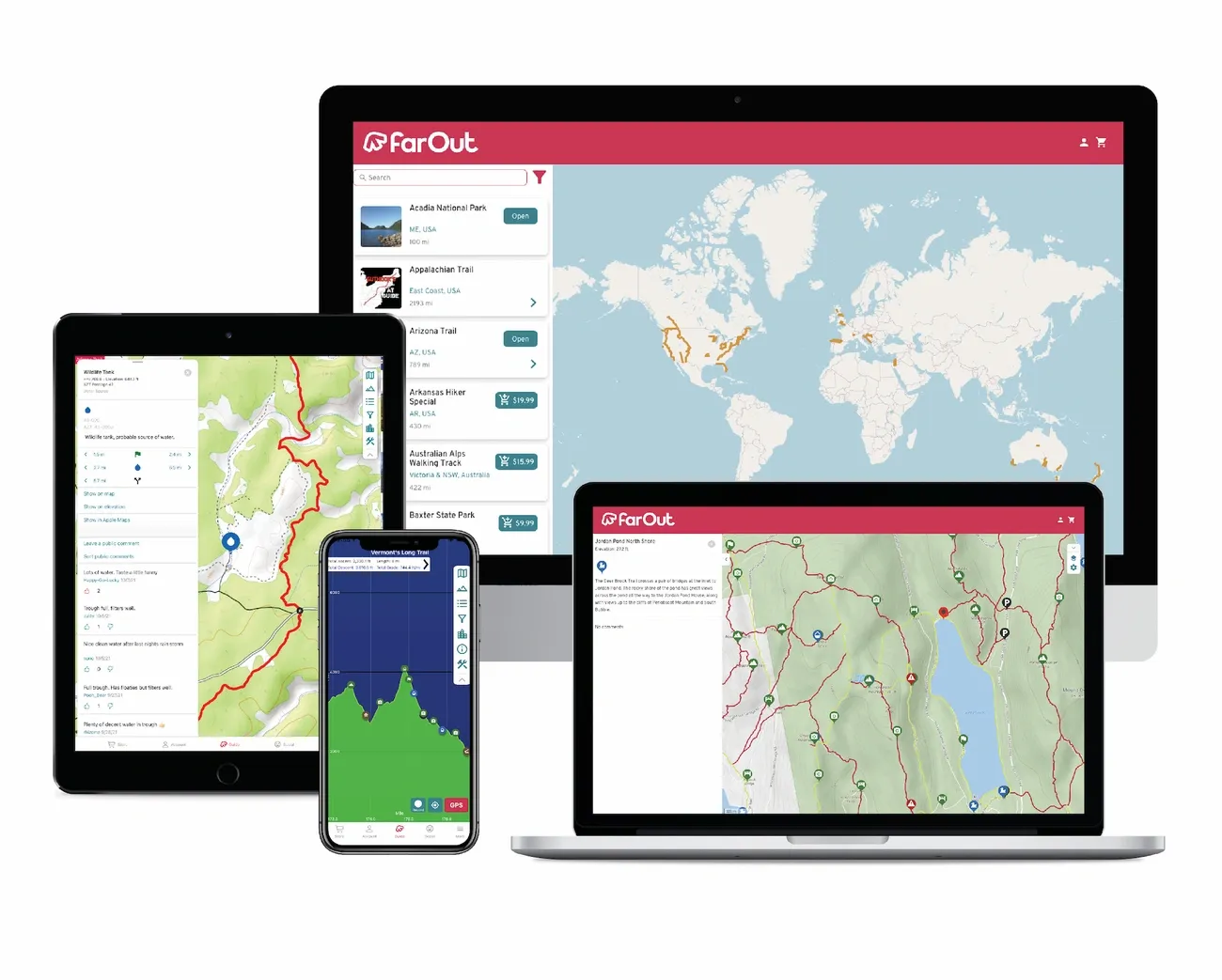
Originally known as Guthook Guides, FarOut has earned its reputation as the premier navigation app for long-distance hiking trails around the world, offering detailed community-driven information even in remote areas.
FarOut key features
FarOut provides meticulously maintained trail data collected by trusted individuals and partner organisations. The app offers comprehensive information through:
Detailed waypoints with photos and descriptions
Community comments on water sources and campsites
Custom route building capabilities
Town guides for resupply points and services
FarOut offline capabilities
Once initially set up, FarOut functions completely offline, utilizing your device’s internal GPS to display current location. After downloading maps and waypoint photos through the “Download Manager,” users can access all features without cell service—including map navigation, elevation profiles, and waypoint information. Even comments made while offline will sync once connectivity returns.
FarOut pricing
FarOut offers flexible payment options:
Monthly: CAD 20.90
Season Pass (6 months): CAD 100.32 (CAD 16.72/month)
Annual: CAD 133.76 (CAD 11.15/month) with 100 Points bonus
Lifetime purchases available for individual trails or sections
FarOut best use case
FarOut excels for long-distance hikers seeking reliable water information and campsite details. The app’s greatest strength lies in its crowdsourced, time-stamped comments that provide near real-time updates about trail conditions. Consequently, it’s ideal for thru-hikers on established routes where community information proves invaluable.
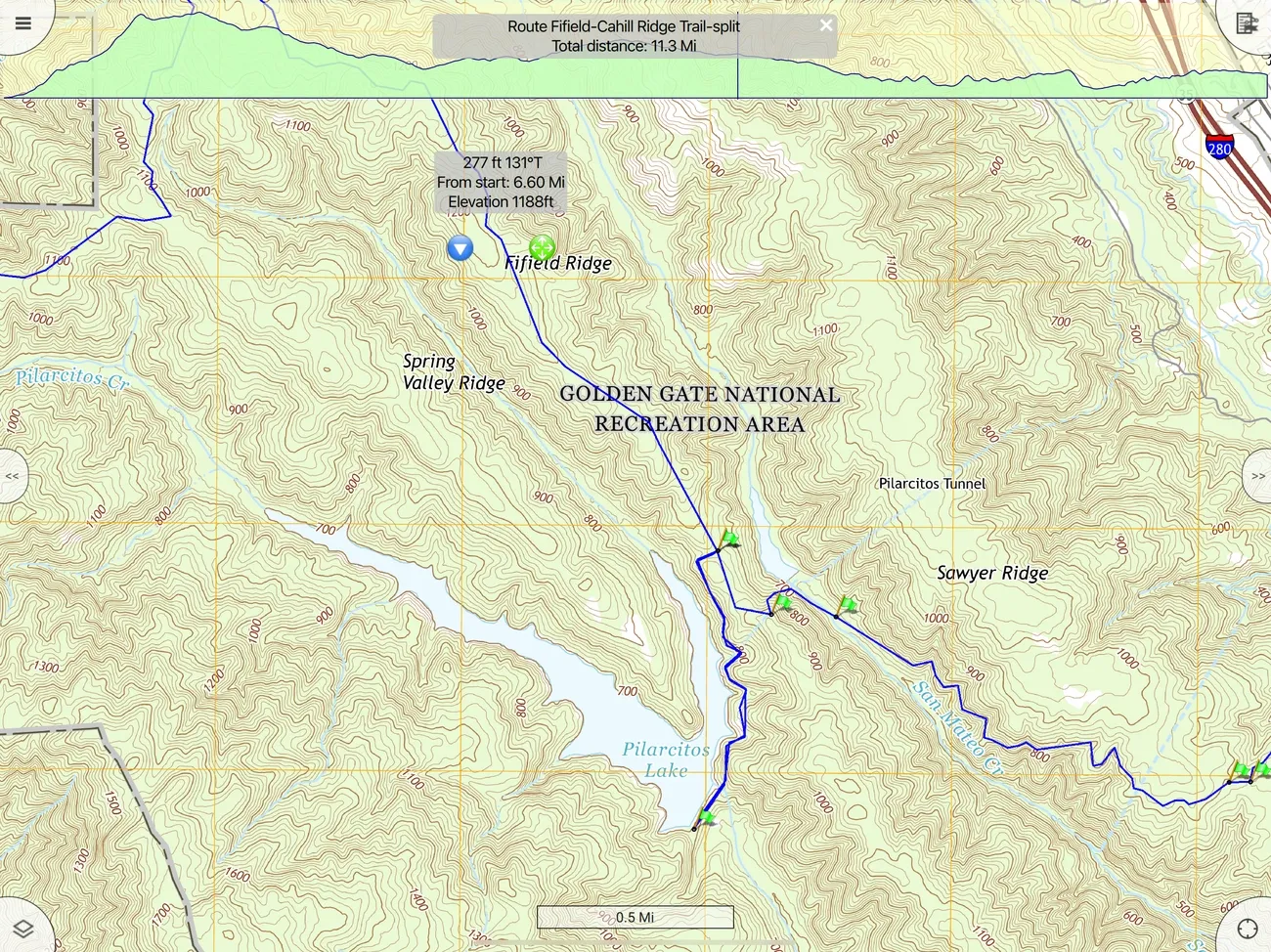
Topo GPS
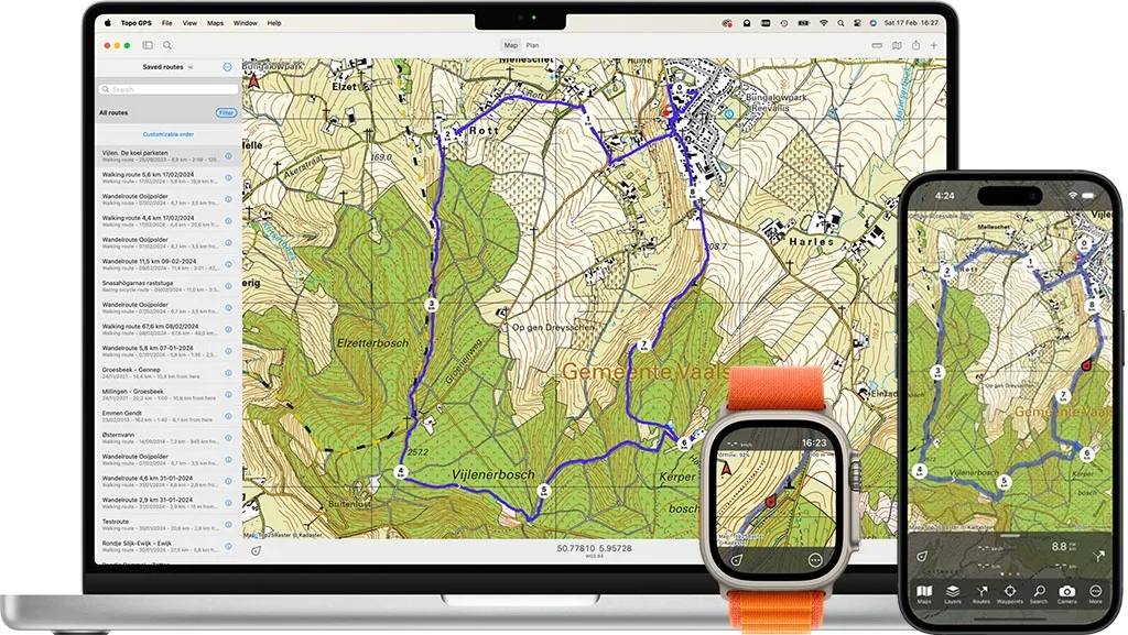
Topo GPS transforms your smartphone into a powerful topographic navigation tool that works even in areas without reception. This privacy-focused app offers detailed maps without requiring user accounts or collecting location data.
Topo GPS key features
Topo GPS provides official topographic maps for numerous countries alongside OpenStreetMap worldwide coverage. Users can plan routes with various transportation methods, create customizable waypoints, and view height profiles. The app supports multiple coordinate systems and allows measurements of distances and angles. Additionally, data can be imported and exported in various formats including GPX, KML, and GeoJSON.
Topo GPS offline capabilities
Once downloaded, map tiles remain accessible without internet connection. The app shows a percentage indicator of offline-accessible tiles for your current viewing area. Users can download specific regions or just the tiles along a planned route. Nevertheless, complete maps cannot be used offline due to file size limitations unless purchased.
Topo GPS pricing
The app follows a straightforward pricing model with one-time purchases rather than subscriptions. Most country maps cost approximately CAD 5.56-9.74 each. For some regions like Great Britain and Belgium, users can purchase sections of maps based on their needs.
Topo GPS best use case
Topo GPS excels for hikers, cyclists, and geocachers who prioritise privacy. The app particularly benefits those seeking detailed topographic information with contour lines in mountainous regions. Furthermore, the minimal interface makes it ideal for users who prefer simplicity over complex features.
Memory-Map for All
Memory-Map for All transforms your device into a fully-featured outdoor GPS, offering identical functionality across iOS, Android, Windows, Mac, and Linux platforms through a unified cross-platform toolkit.
Memory-Map key features
Memory-Map provides intuitive route planning with simple mouse clicks and optional auto-routing optimized for walking, cycling, or driving. The app features 3D visualisation that brings maps to life within a virtual landscape, allowing users to change lighting and shadows to simulate different times of day. Furthermore, the interface enables customisable map displays, powerful overlay data management, and interactive graphs showing terrain elevation profiles.
Memory-Map offline capabilities
Once downloaded, maps remain accessible without cellular coverage or internet connection. Users can prepare for trips by downloading detailed coverage in advance through several methods: downloading entire map packages, capturing maps along planned routes, or selecting custom areas. Memory-Map automatically stores viewed map areas for later offline access, making preparation straightforward even minutes before departure.
Memory-Map pricing
Unlike subscription-based competitors, Memory-Map follows a “buy the maps, use the app for free” business model. Map prices vary based on publisher royalties, ranging from CAD 6.97 to CAD 278.67 or more. Many maps offer free demo periods, allowing users to test before purchasing.
Memory-Map best use case
According to reviewer Alex Roddie, Memory-Map excels for “advanced users willing to put time into learning its interface”. The app particularly suits outdoor enthusiasts requiring detailed topographic information without cellular coverage. Additionally, it serves marine navigators with features like AIS collision alerts and anchor alarms.
Avenza Maps

Avenza Maps empowers outdoor enthusiasts with over one million offline maps and robust GPS functionality that works even in the most remote locations. This versatile navigation tool serves both recreational hikers and professionals requiring precise location tracking.
Avenza Maps key features
Avenza Maps boasts an impressive collection of georeferenced maps from professional publishers worldwide. Key capabilities include:
Exact GPS location tracking without internet connection
Ability to mark places of interest and attach photos
Distance measurement and route plotting tools
What3words integration for precise location sharing
Geofence creation that sends notifications upon entry or exit
Avenza Maps offline capabilities
Once downloaded, maps remain fully functional without cell service or internet connectivity. The app uses your device’s built-in GPS to display your exact location on any map. All features—including navigation, placemarks, and distance measurement—work completely offline.
Avenza Maps pricing
Avenza Maps offers three subscription tiers:
Free: Basic functionality with up to 3 custom map imports
Plus: CAD 48.75/year for recreational users needing up to 20 custom maps
Pro: From CAD 236.86/year for commercial/academic use with unlimited custom maps
Avenza Maps best use case
Avenza Maps excels for hiking in extremely remote areas where detailed offline navigation is essential. The app is ideal for professionals requiring field data collection and those needing specialised map types beyond typical hiking trails.
Garmin Explore
Partnering perfectly with Garmin’s physical devices, Garmin Explore offers hikers a comprehensive navigation solution that bridges hardware and software worlds. This versatile app works independently or alongside compatible Garmin devices for enhanced functionality.
Garmin Explore key features
Garmin Explore provides essential tools for outdoor navigation through several standout features. Users can easily create waypoints and routes directly within the app. The software includes downloadable topographic and aerial maps for detailed terrain visualization. Additionally, the app organizes data into collections, making it straightforward to locate courses or waypoints from previous expeditions. Other noteworthy capabilities include:
Search tools for locating geographic points like trailheads or mountain summits
Cloud storage for waypoints, routes, and activities
LiveTrack feature for real-time location sharing
Garmin Explore offline capabilities
Overall, Garmin Explore excels in offline functionality. Users can download maps directly to their smartphones, afterward accessing them without cellular service. The app allows syncing with compatible Garmin devices even without internet connection. Fundamentally, this enables complete navigation capabilities while off-grid, including topographic visualisation and route tracking.
Garmin Explore pricing
Presently, Garmin Explore offers basic map downloads free of charge. Simply, users can access topographic maps and satellite imagery without purchasing a subscription. Although, recent updates now require an “Outdoor Maps+” subscription (CAD 69.67/year) for premium features that were previously included.
Garmin Explore best use case
Straightaway, this app proves most valuable for hikers who already own compatible Garmin devices. The seamless integration between hardware and software creates an enhanced navigation experience. Furthermore, it serves adventurers who require reliable offline mapping with cloud backup once reconnected to service.
OS Locate
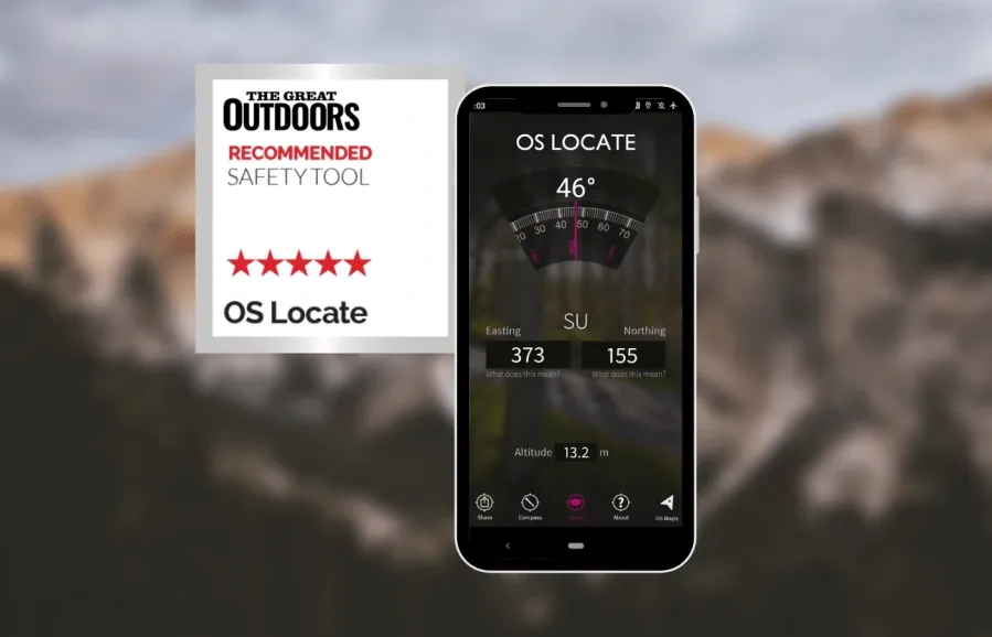
Created by Ordnance Survey, OS Locate functions as a digital compass that pinpoints your exact location on OS maps even in remote areas with no connectivity. Following recent updates, this tool now comes embedded within the OS Maps app rather than as a standalone application.
OS Locate key features
OS Locate instantly converts your GPS location into OS grid references, showing precise coordinates for eastings, northings, and elevation data. The app displays a digital compass that helps users navigate accurately, alongside an innovative “camera compass” feature that transforms your phone into an augmented reality navigation tool. Beyond navigation, users can share their location via messaging or social media, enabling loved ones to track adventures.
OS Locate offline capabilities
Significantly, OS Locate operates without requiring any mobile signal. The app relies solely on your device’s built-in GPS system, which functions even in the most isolated locations. Since calibration improves accuracy, rotating your phone in a figure-eight motion helps deliver more precise readings. To maximize battery life, turning on flight mode while using GPS is recommended.
OS Locate pricing
Completely free to use, OS Locate now comes integrated within the OS Maps app at no additional cost. Hence, users need only download the OS Maps application to access all OS Locate functionality.
OS Locate best use case
Primarily, OS Locate serves as an ideal companion alongside traditional paper maps and compasses. It excels as an emergency backup tool for determining precise location when disoriented. Indeed, the app was designed as a complementary tool rather than a replacement for proper navigation equipment.
What3Words

What3Words tackles location precision through an innovative approach: dividing the entire planet into 3-meter squares, each assigned a unique three-word address that works anywhere.
What3Words key features
What3Words uses three random words to identify precise locations, making it easier to communicate exact spots than coordinates or vague descriptions. The system functions globally with coverage in over 60 languages. Users can navigate to any what3words address using preferred navigation apps like Google Maps. The app enables location sharing via text messages or links that recipients can view even without installing the app. Unlike street addresses that often identify entire buildings, what3words addresses pinpoint specific entrances with 3-meter accuracy.
What3Words offline capabilities
Remarkably, the app functions fully offline without data or cellular connection. This capability relies on GPS signals which have near-universal coverage worldwide. While offline, users can find their current three-word location and navigate to other locations using compass mode. At the same time, sharing addresses with others or loading maps still requires connectivity. This offline functionality proves particularly valuable for hikers in remote areas with limited access to data.
What3Words pricing
The app and online map remain completely free for personal use. What3Words generates revenue by charging businesses that integrate the technology into their platforms. Emergency services typically access the system at no cost.
What3Words best use case
First thing to remember, What3Words excels for outdoor enthusiasts meeting at specific locations without obvious landmarks. Actually, hikers can pinpoint exact trail entrances, viewpoints, or meeting spots with just three words. Additionally, the app serves as a safety tool—over 85% of UK emergency services use What3Words.
Cairn

Safety-focused and innovative, Cairn stands out among hiking apps by prioritizing hiker wellbeing through real-time tracking and emergency notifications.
Cairn key features
Cairn helps hikers stay safe by enabling them to share trip plans with safety contacts. The app crowdsources cell coverage data, showing users where they might find signals on trails. Primarily, it provides live tracking, allowing contacts to monitor your GPS location throughout adventures. Coupled with this, the app delivers trail statistics including distance hiked, elevation gained, and estimated arrival times.
Cairn offline capabilities
Not only does Cairn work offline, but it functions even when your phone loses reception. For optimal use, download maps for your exploration area beforehand. Even if your device loses connection, safety contacts will receive alerts if you’re overdue, regardless of your phone’s status. This feature operates independently of cellular service, offering peace of mind in remote locations.
Cairn pricing
The app offers a free version with basic functionality. A 7-day free trial provides access to all premium features. After the trial, Cairn Premium costs CAD 6.95/month or CAD 37.61/year (CAD 3.14/month). Premium unlocks real-time location sharing, automatic overdue alerts, offline maps, and customisable trail time estimates.
Cairn best use case
Cairn excels for solo hikers wanting added security. Given its safety focus, it’s ideal for adventurers exploring unfamiliar or remote terrain. The app proves particularly valuable for those whose loved ones worry about their outdoor pursuits.
Windy
Trusted by adventurers worldwide, Windy offers dynamic weather visualizations that transform complex meteorological data into intuitive heat maps and forecasts specifically designed for outdoor activities.
Windy key features
Windy provides customizable weather profiles tailored to various activities including mountain hiking. The app displays constantly changing heat maps allowing users to filter indicators by altitude—ideal for mountaineers requiring specialized information. Furthermore, Windy stores weather history for every day over the past 10 years (2012-2021), enabling hikers to plan trips during optimal seasons. The World Meteorological Organization has recognized Windy as the best weather app for outdoor activities.
Windy offline capabilities
Crucially for backcountry explorers, Windy offers offline mode for areas with poor internet connectivity. Users can download weather forecasts for favorite spots before venturing into remote locations. This preparation ensures access to accurate weather data regardless of connectivity status. To conserve phone memory, users can download specific map sections rather than entire regions.
Windy pricing
Windy maintains a freemium model where basic features remain accessible without payment. Premium subscriptions unlock additional features and more precise forecast models, starting with a 7-day free trial. Annual subscriptions offer better value than monthly options. Interestingly, users can occasionally obtain free premium access through promotions, referrals, or social media reviews.
Windy best use case
Windy excels for mountaineers requiring altitude-specific weather information. The app proves invaluable for hiking trips lasting 2-3 hours by providing granular forecasts beyond standard 3-hour intervals. In essence, Windy serves hikers needing specialized weather data beyond basic temperature and precipitation readings.
Conclusion
Adventures through remote trails now come with greater peace of mind thanks to these offline-capable hiking apps. Smartphones have truly become indispensable hiking companions, functioning as reliable navigation tools even when cell towers are nowhere in sight.
Each app on this list serves distinct purposes and hiking styles. Gaia GPS and AllTrails excel for comprehensive mapping and trail databases, while specialized options like FarOut cater perfectly to thru-hikers on established long-distance routes. Safety-focused hikers will find Cairn and What3Words invaluable for emergency situations or precise location sharing.
Weather considerations remain equally critical for backcountry exploration. Apps like Windy and Met Office Weather provide detailed forecasts you can download before departure, thus eliminating nasty surprises during your adventure.
Price points vary significantly across these applications. Several offer free basic versions with premium upgrades, while others require one-time purchases or annual subscriptions. Your hiking frequency and specific needs should guide which investment makes most sense for your adventures.
Remember that no app replaces proper preparation and basic navigation skills. These digital tools work best as complements to traditional maps, compasses, and thorough trip planning. Battery conservation also deserves attention – airplane mode dramatically extends your device’s life while still allowing GPS functionality.
The wilderness awaits with fewer uncertainties than ever before. Whether trekking through dense forests, scaling remote peaks, or wandering off established paths, these 15 apps ensure you can navigate confidently without cellular connectivity. Pack your essentials, charge your devices, download your maps, and hit the trails knowing you’ve got reliable guidance at your fingertips, regardless of signal strength.